
Thank you for supporting this site ❤️
Make a donation
Make a donation
Gear up for your next adventure:
As an Amazon Associate, this site earns from qualifying purchases at no extra cost to you.
Waze topographic map
Click on the map to display elevation.
Thank you for supporting this site ❤️
Make a donation
Make a donation
Gear up for your next adventure:
As an Amazon Associate, this site earns from qualifying purchases at no extra cost to you.
About this map
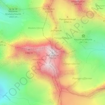
Name: Waze topographic map, elevation, terrain.
Location: Waze, St. Leonhard im Pitztal, Imst, Tirol, Österreich (46.98962 10.79537 46.98972 10.79547)
Average elevation: 2,932 m
Minimum elevation: 2,418 m
Maximum elevation: 3,490 m
Thank you for supporting this site ❤️
Make a donation
Make a donation
Gear up for your next adventure:
As an Amazon Associate, this site earns from qualifying purchases at no extra cost to you.