Geolocate

Saukville topographic map

Click on the map to display elevation.

About this map

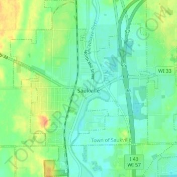
Name: Saukville topographic map, elevation, terrain.

Location: Saukville, Ozaukee County, Wisconsin, 53080, United States (43.36001 -87.96760 43.40429 -87.91677)

Average elevation: 238 m

Minimum elevation: 225 m

Maximum elevation: 263 m

Other topographic maps

Click on a map to view its topography, its elevation and its terrain.

Donges Bay

United States > Wisconsin > Ozaukee County

Average elevation: 190 m

Gear up for your next adventure:

🩹Compact First Aid Kit - Pre-packed essentials for common trail injuries
🧴Bear Spray Holster - Quick-access carry for essential Canadian wilderness safety
🥾Trekking Boots - Durable boots for long-distance trekking
🧥Softshell Hiking Jacket - The perfect balance of wind protection and breathability
🥾Hiking Boots - Sturdy boots providing ankle support and traction on rugged trails

As an Amazon Associate, this site earns from qualifying purchases at no extra cost to you.