Geolocate

Kaba topographic map

Click on the map to display elevation.

About this map

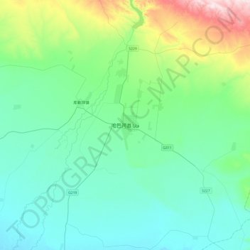
Name: Kaba topographic map, elevation, terrain.

Location: Kaba, 阿克齐镇, Habahe County, Altay Prefecture, Xinjiang, China (47.89950 86.24992 48.21950 86.56992)

Average elevation: 557 m

Minimum elevation: 445 m

Maximum elevation: 1,034 m

Gear up for your next adventure:

🧭Orienteering Kit - Tools for map reading and navigation in the wild
🧥Ultralight Puffy Jacket - Maximum warmth that packs down to the size of an orange
🧰Emergency Multi-Tool - Compact multi-tool for outdoor survival
🩹Compact First Aid Kit - Pre-packed essentials for common trail injuries
🧢Outdoor Visor - Breathable visor for sunny hikes

As an Amazon Associate, this site earns from qualifying purchases at no extra cost to you.