Geolocate

Emerson topographic map

Click on the map to display elevation.

About this map

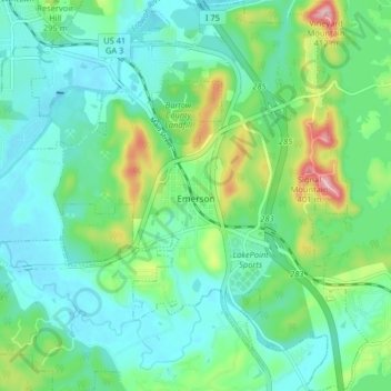
Name: Emerson topographic map, elevation, terrain.

Location: Emerson, Bartow County, Georgia, 30137, United States (34.09402 -84.78494 34.16097 -84.71986)

Average elevation: 254 m

Minimum elevation: 205 m

Maximum elevation: 402 m

Other topographic maps

Click on a map to view its topography, its elevation and its terrain.

Stilesboro

United States > Georgia > Bartow County

Average elevation: 220 m

Corbin

United States > Georgia > Bartow County

Average elevation: 308 m

Rydal

United States > Georgia > Bartow County

Average elevation: 273 m

Gear up for your next adventure:

Lightweight Camping Tent - Portable shelter optimized for Canadian backcountry camping
🧦Merino Wool Socks - Moisture-wicking comfort for long-distance hiking
🧥Ultralight Puffy Jacket - Maximum warmth that packs down to the size of an orange
🧥Thermal Fleece Jacket - Versatile insulation for changing mountain temperatures
🔥Emergency Fire Starter - Reliable ignition source for all weather conditions

As an Amazon Associate, this site earns from qualifying purchases at no extra cost to you.