Geolocate

College Corner topographic map

Click on the map to display elevation.

About this map

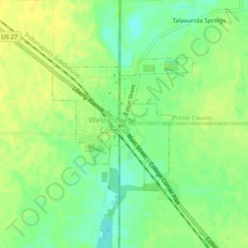
Name: College Corner topographic map, elevation, terrain.

Location: College Corner, Oxford Township, Butler County, Ohio, United States (39.56042 -84.81514 39.57485 -84.80481)

Average elevation: 304 m

Minimum elevation: 292 m

Maximum elevation: 312 m

Other topographic maps

Click on a map to view its topography, its elevation and its terrain.

West Chester

United States > Ohio > Butler County > West Chester

Average elevation: 231 m

Williamsdale

United States > Ohio > Butler County

Average elevation: 193 m

Woodsdale

United States > Ohio > Butler County

Average elevation: 204 m

Okeana

United States > Ohio > Butler County

Average elevation: 226 m

Darrtown

United States > Ohio > Butler County

Average elevation: 238 m

Wieche Field

United States > Ohio > Butler County > Seven Mile

Average elevation: 208 m

Mayfield

United States > Ohio > Butler County > Middletown

Average elevation: 212 m

Crawford Woods

United States > Ohio > Butler County > Hamilton

Average elevation: 205 m

Astoria

United States > Ohio > Butler County

Average elevation: 263 m

Macedonia

United States > Ohio > Butler County

Average elevation: 247 m

Bethany

United States > Ohio > Butler County

Average elevation: 259 m

Peffer Park

United States > Ohio > Butler County > Oxford

Average elevation: 265 m

Gear up for your next adventure:

🧥Ultralight Puffy Jacket - Maximum warmth that packs down to the size of an orange
🧭GPS Outdoor Watch - Smart watch for navigation and fitness tracking in nature
🧣Evaporative Cooling Towel - Beat the heat during intense summer climbs
🧊Portable Cooler - Keep food and drinks cold during outdoor adventures
🥾Trekking Boots - Durable boots for long-distance trekking

As an Amazon Associate, this site earns from qualifying purchases at no extra cost to you.