Geolocate

Mna topographic map

Click on the map to display elevation.

About this map

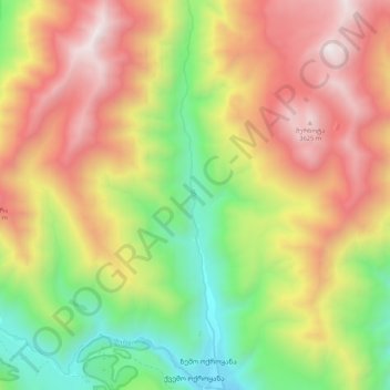
Name: Mna topographic map, elevation, terrain.

Location: Mna, Kazbegi Municipality, Mtskheta-Mtianeti, Georgia (42.58059 44.45854 42.65859 44.47068)

Average elevation: 2,826 m

Minimum elevation: 2,007 m

Maximum elevation: 3,701 m

Gear up for your next adventure:

🛌Down Sleeping Bag - Superior warmth-to-weight ratio for cold nights
🛶Kayak Dry Bag - Waterproof storage for kayaking adventures
🥾All-Terrain Hiking Boots - Versatile boots for varied hiking conditions
💧Reusable Water Bottle - Durable water bottles for hydration on trails
🕶️Polarized Sunglasses - Reduces glare from snow and water at high elevations

As an Amazon Associate, this site earns from qualifying purchases at no extra cost to you.