
Make a donation
Gear up for your next adventure:
As an Amazon Associate, this site earns from qualifying purchases at no extra cost to you.
Greensboro topographic map
Click on the map to display elevation.
Make a donation
Gear up for your next adventure:
As an Amazon Associate, this site earns from qualifying purchases at no extra cost to you.
About this map
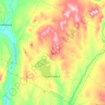
Name: Greensboro topographic map, elevation, terrain.
Location: Greensboro, Orleans County, Vermont, 05841, United States (44.54249 -72.37386 44.66490 -72.20249)
Average elevation: 447 m
Minimum elevation: 241 m
Maximum elevation: 691 m
Make a donation
Gear up for your next adventure:
As an Amazon Associate, this site earns from qualifying purchases at no extra cost to you.
Other topographic maps
Click on a map to view its topography, its elevation and its terrain.
Newport Center
United States > Vermont > Orleans County > Newport Town > Newport Center
Average elevation: 263 m
Make a donation
Gear up for your next adventure:
As an Amazon Associate, this site earns from qualifying purchases at no extra cost to you.