Geolocate

Jalan topographic map

Click on the map to display elevation.

About this map

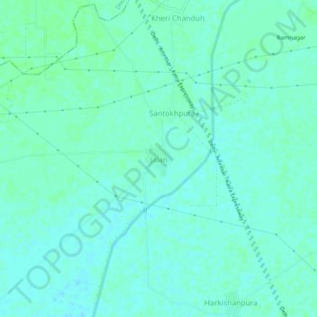
Name: Jalan topographic map, elevation, terrain.

Location: Jalan, Sangrur Tahsil, Sangrur District, Punjab, India (30.27179 75.94561 30.31179 75.98561)

Average elevation: 240 m

Minimum elevation: 237 m

Maximum elevation: 244 m

Gear up for your next adventure:

🦶Hiking Shoe Insoles - Added support for high arches and long days on feet
Camping Tent - Weather-resistant tents suitable for 2 to 6 people
🧴Bear Spray Holster - Quick-access carry for essential Canadian wilderness safety
💧Hydration Bladder - Hands-free hydration solution for long treks
🛏️Camping Sleeping Mat - Comfortable mats for sleeping outdoors

As an Amazon Associate, this site earns from qualifying purchases at no extra cost to you.