Geolocate

Cochacasa topographic map

Click on the map to display elevation.

About this map

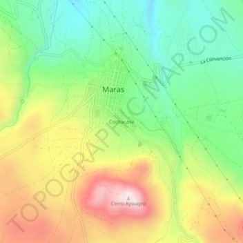
Name: Cochacasa topographic map, elevation, terrain.

Location: Cochacasa, Maras, Urubamba, Cusco, 08660, Perú (-13.36066 -72.17507 -13.32066 -72.13507)

Average elevation: 3,409 m

Minimum elevation: 3,194 m

Maximum elevation: 3,706 m

Gear up for your next adventure:

🔨Vehicle Emergency Tool - Safety tool for remote road trips to trailheads
🦶Hiking Shoe Insoles - Added support for high arches and long days on feet
🥾Hiking Shoes - Durable and comfortable shoes for trail hiking
🚲MTB Frame Bag - Carry tools and maps directly on your bicycle frame
🥾Hiking Shorts - Breathable shorts suitable for summer hikes

As an Amazon Associate, this site earns from qualifying purchases at no extra cost to you.