Geolocate

Degloor topographic map

Click on the map to display elevation.

About this map

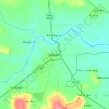
Name: Degloor topographic map, elevation, terrain.

Location: Degloor, Deglur, Nanded District, Maharashtra, 431717, India (18.50966 77.53909 18.58966 77.61909)

Average elevation: 374 m

Minimum elevation: 354 m

Maximum elevation: 431 m

Gear up for your next adventure:

🥾Waterproof Hiking Boots - Essential footwear for rugged terrain and wet Canadian trails
🧥Softshell Jacket - Windproof and breathable jacket for hiking
🚲Heavy Duty Bike Lock - Secure your bike at the trailhead or during stops
Tent Footprint - Protect tent floor and increase durability
🥾Waterproof Hiking Shoes - Durable shoes for wet and rugged trails

As an Amazon Associate, this site earns from qualifying purchases at no extra cost to you.