Geolocate

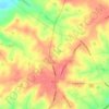
Marston topographic map

Click on the map to display elevation.

About this map

Name: Marston topographic map, elevation, terrain.

Location: Marston, Richmond County, North Carolina, 28363, United States (34.96821 -79.60227 35.00821 -79.56227)

Average elevation: 120 m

Minimum elevation: 88 m

Maximum elevation: 150 m

Other topographic maps

Click on a map to view its topography, its elevation and its terrain.

Hamlet

United States > North Carolina > Richmond County

Average elevation: 102 m

Ellerbe

United States > North Carolina > Richmond County

Average elevation: 145 m

Hoffman

United States > North Carolina > Richmond County

Average elevation: 121 m

Hamlet

United States > North Carolina > Richmond County

Average elevation: 102 m

Gear up for your next adventure:

🧣Merino Neck Gaiter - Protects against wind, sun, and cold at high altitudes
⛺Camping Tent - Weather-resistant tents suitable for 2 to 6 people
🔥Camping Stove - Portable stoves to cook outdoors with ease
🥾Lightweight Hiking Shoes - Comfortable shoes for day hikes
🧢Outdoor Cap - Protective cap for sun and rain during hikes

As an Amazon Associate, this site earns from qualifying purchases at no extra cost to you.