
Thank you for supporting this site ❤️
Make a donation
Make a donation
Gear up for your next adventure:
As an Amazon Associate, this site earns from qualifying purchases at no extra cost to you.
Putumajore/Pozzomaggiore topographic map
Click on the map to display elevation.
Thank you for supporting this site ❤️
Make a donation
Make a donation
Gear up for your next adventure:
As an Amazon Associate, this site earns from qualifying purchases at no extra cost to you.
About this map
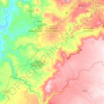
Name: Putumajore/Pozzomaggiore topographic map, elevation, terrain.
Location: Putumajore/Pozzomaggiore, Sassari, Sardinia, 07018, Italy (40.29688 8.56882 40.43841 8.69901)
Average elevation: 411 m
Minimum elevation: 129 m
Maximum elevation: 657 m
Thank you for supporting this site ❤️
Make a donation
Make a donation
Gear up for your next adventure:
As an Amazon Associate, this site earns from qualifying purchases at no extra cost to you.
Other topographic maps
Click on a map to view its topography, its elevation and its terrain.