Geolocate

Mount Davis topographic map

Click on the map to display elevation.

About this map

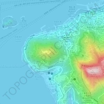
Name: Mount Davis topographic map, elevation, terrain.

Location: Mount Davis, Hong Kong Island, Hong Kong, China (22.27690 114.12481 22.27700 114.12491)

Average elevation: 71 m

Minimum elevation: -1 m

Maximum elevation: 440 m

Other topographic maps

Click on a map to view its topography, its elevation and its terrain.

Ap Lei Chau

China > Hong Kong > Hong Kong Island

Average elevation: 25 m

Gear up for your next adventure:

🎒Backpack Rain Cover - External shield to keep your entire pack dry
🧰Survival Kit - Essential gear for emergencies in the wilderness
🧢Sun Protection Cap - Breathable cap to protect from sun exposure
🧥Softshell Hiking Jacket - The perfect balance of wind protection and breathability
👖Convertible Hiking Pants - Zip-off legs to adapt to changing weather conditions

As an Amazon Associate, this site earns from qualifying purchases at no extra cost to you.