Geolocate

Kibbee topographic map

Click on the map to display elevation.

About this map

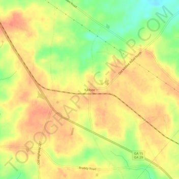
Name: Kibbee topographic map, elevation, terrain.

Location: Kibbee, Montgomery County, Georgia, 30470, United States (32.26768 -82.54513 32.30768 -82.50513)

Average elevation: 87 m

Minimum elevation: 57 m

Maximum elevation: 103 m

Other topographic maps

Click on a map to view its topography, its elevation and its terrain.

Tarrytown

United States > Georgia > Montgomery County

Average elevation: 83 m

Alston

United States > Georgia > Montgomery County

Average elevation: 70 m

Higgston

United States > Georgia > Montgomery County

Average elevation: 85 m

Uvalda

United States > Georgia > Montgomery County

Average elevation: 59 m

Ailey

United States > Georgia > Montgomery County

Average elevation: 73 m

Gear up for your next adventure:

🔭Compact Monocular - One-handed bird watching and trail spotting
🧥Packable Rain Jacket - Breathable waterproof layer for unpredictable weather
🔥Camping Stove - Portable stoves to cook outdoors with ease
🥾Trekking Poles - Adjustable trekking poles to reduce knee stress and improve stability
🧦Outdoor Socks - Durable socks designed for hiking and outdoor sports

As an Amazon Associate, this site earns from qualifying purchases at no extra cost to you.