Geolocate

Santa Maria topographic map

Click on the map to display elevation.

About this map

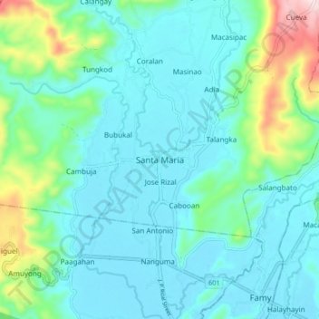
Name: Santa Maria topographic map, elevation, terrain.

Location: Santa Maria, Laguna, Calabarzon, 4022, Philippines (14.43002 121.38305 14.51002 121.46305)

Average elevation: 77 m

Minimum elevation: 1 m

Maximum elevation: 407 m

Gear up for your next adventure:

🛌Insulated Sleeping Pad - Critical thermal barrier between you and the cold ground
🔦UV Flashlight - Detect minerals or specific insects in the dark
🐕Hiking Dog Pack - Let your canine companion carry their own water and food
🎒Hiking Backpack - Lightweight and ergonomic backpacks for day hikes or multi-day treks
Lightweight Backpacking Tent - Compact tent for efficient hiking trips

As an Amazon Associate, this site earns from qualifying purchases at no extra cost to you.