
Babatan topographic map
Interactive map
Click on the map to display elevation.
About this map
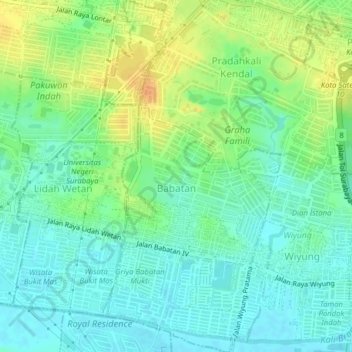
Name: Babatan topographic map, elevation, terrain.
Location: Babatan, Wiyung, Surabaya, Jawa Timur, Jawa, Indonésie (-7.32157 112.67159 -7.28269 112.69027)
Average elevation: 16 m
Minimum elevation: 4 m
Maximum elevation: 36 m
Other topographic maps
Click on a map to view its topography, its elevation and its terrain.
Kapasmadya Baru
Indonésie > Jawa Timur > Surabaya
Kapasmadya Baru, Tambaksari, Surabaya, Jawa Timur, Indonésie
Average elevation: 4 m