Geolocate

San Isidro topographic map

Click on the map to display elevation.

About this map

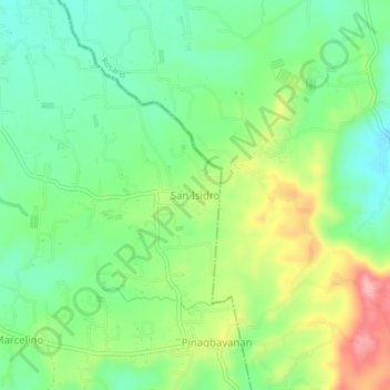
Name: San Isidro topographic map, elevation, terrain.

Location: San Isidro, Taysan, Batangas, Calabarzon, Philippines (13.74831 121.22770 13.78831 121.26770)

Average elevation: 175 m

Minimum elevation: 123 m

Maximum elevation: 265 m

Gear up for your next adventure:

🚲Heavy Duty Bike Lock - Secure your bike at the trailhead or during stops
🔦LED Headtorch - Bright and durable light for night activities
💧Collapsible Water Bottle - Space-saving water bottle for outdoor activities
🥾Trekking Poles - Adjustable trekking poles to reduce knee stress and improve stability
🧢Hiking Sun Hat - Wide-brimmed protection for exposed mountain ridges

As an Amazon Associate, this site earns from qualifying purchases at no extra cost to you.