Geolocate

Coronation Park topographic map

Click on the map to display elevation.

About this map

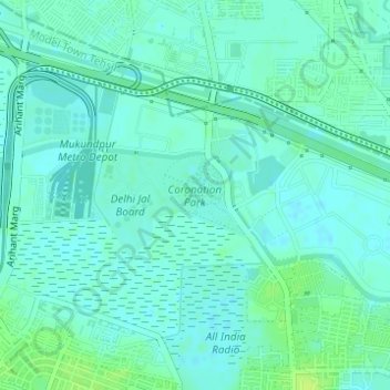
Name: Coronation Park topographic map, elevation, terrain.

Location: Coronation Park, Model Town Tehsil, North Delhi, Delhi, India (28.71965 77.19339 28.72530 77.20084)

Average elevation: 209 m

Minimum elevation: 204 m

Maximum elevation: 217 m

Other topographic maps

Click on a map to view its topography, its elevation and its terrain.

Mukherjee Nagar

India > Delhi > Model Town Tehsil

Average elevation: 211 m

Hakikat Nagar

India > Delhi > Model Town Tehsil

Average elevation: 215 m

Gandhi Vihar

India > Delhi > Model Town Tehsil

Average elevation: 209 m

Gear up for your next adventure:

🧥Waterproof Jacket - Lightweight rain jackets for hiking and outdoor activities
🧤Thermal Hiking Gloves - Grip-enhanced gloves for cold-weather altitude trekking
🧰Multitool Knife - Compact and versatile tool for outdoor use
🔦LED Headlamp - Hands-free lighting for early morning starts or late finishes
🧢Sun Hat - Wide-brim hat for sun protection

As an Amazon Associate, this site earns from qualifying purchases at no extra cost to you.