Geolocate

Myrdon topographic map

Click on the map to display elevation.

About this map

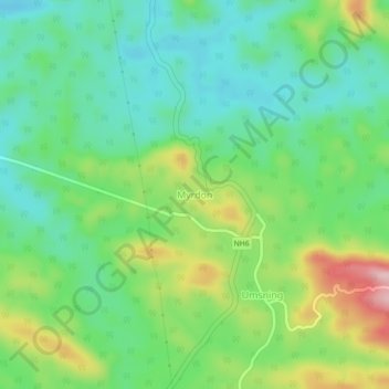
Name: Myrdon topographic map, elevation, terrain.

Location: Myrdon, Umsning, Ri-Bhoi District, Meghalaya, India (25.73583 91.85954 25.77583 91.89954)

Average elevation: 755 m

Minimum elevation: 680 m

Maximum elevation: 906 m

Gear up for your next adventure:

💡Portable Camping Lamp - Rechargeable lamp for campsite lighting
💧Filtered Water Bottle - Safe drinking water on the go
🥾All-Terrain Hiking Boots - Versatile boots for varied hiking conditions
🔦UV Flashlight - Detect minerals or specific insects in the dark
🥾Lightweight Hiking Shoes - Comfortable shoes for day hikes

As an Amazon Associate, this site earns from qualifying purchases at no extra cost to you.