Geolocate

Cascajal topographic map

Click on the map to display elevation.

About this map

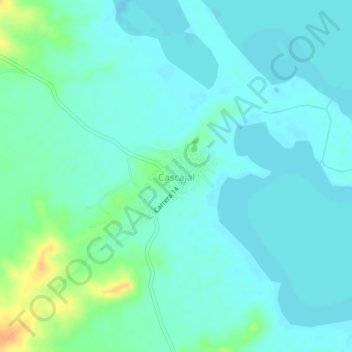
Name: Cascajal topographic map, elevation, terrain.

Location: Cascajal, Magangué, Mojana, Bolívar, Colombia (9.29497 -74.82651 9.33497 -74.78651)

Average elevation: 18 m

Minimum elevation: 10 m

Maximum elevation: 47 m

Gear up for your next adventure:

🥾Trail Hiking Socks - Comfortable socks to prevent blisters and fatigue
🧥Waterproof Jacket - Lightweight rain jackets for hiking and outdoor activities
🪑Insulated Seat Pad - Protect your seat from cold rocks and wet logs
🏕️Camping Hammock - Integrated protection for sleeping between trees
🧥Thermal Layer - Insulating layer for cold outdoor conditions

As an Amazon Associate, this site earns from qualifying purchases at no extra cost to you.