Geolocate

Rionegro topographic map

Click on the map to display elevation.

About this map

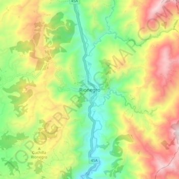
Name: Rionegro topographic map, elevation, terrain.

Location: Rionegro, Santander, Colombia (7.22463 -73.19028 7.30463 -73.11028)

Average elevation: 1,004 m

Minimum elevation: 547 m

Maximum elevation: 1,614 m

Gear up for your next adventure:

🧊Insulated Water Bottle - Keeps drinks cold in summer and prevents freezing in winter
💡Portable Camping Lamp - Rechargeable lamp for campsite lighting
🥾Trail Hiking Boots - Supportive boots for rough trails
🧶550 Survival Paracord - Versatile utility cord for emergency repairs and rigging
🪑Insulated Seat Pad - Protect your seat from cold rocks and wet logs

As an Amazon Associate, this site earns from qualifying purchases at no extra cost to you.