Geolocate

Mallard topographic map

Click on the map to display elevation.

About this map
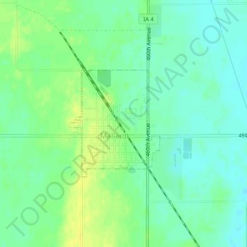
Name: Mallard topographic map, elevation, terrain.

Location: Mallard, Palo Alto County, Iowa, United States (42.93330 -94.69027 42.94499 -94.67682)

Average elevation: 370 m

Minimum elevation: 362 m

Maximum elevation: 382 m

Gear up for your next adventure:

🧣Merino Neck Gaiter - Protects against wind, sun, and cold at high altitudes
🔭Compact Binoculars - Lightweight optics for scouting trails and wildlife
🚑Survival Whistle - Signal for help across long distances in mountains
🧣Evaporative Cooling Towel - Beat the heat during intense summer climbs
⛺Camping Groundsheet - Protect your tent from moisture and dirt

As an Amazon Associate, this site earns from qualifying purchases at no extra cost to you.