
Thank you for supporting this site ❤️
Make a donation
Make a donation
Gear up for your next adventure:
As an Amazon Associate, this site earns from qualifying purchases at no extra cost to you.
Avantipora topographic map
Click on the map to display elevation.
Thank you for supporting this site ❤️
Make a donation
Make a donation
Gear up for your next adventure:
As an Amazon Associate, this site earns from qualifying purchases at no extra cost to you.
About this map
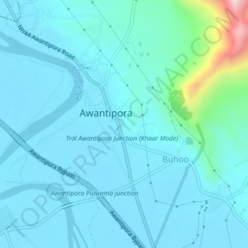
Name: Avantipora topographic map, elevation, terrain.
Location: Avantipora, Awantipora, Pulwama, Jammu and Kashmir, India (33.90872 75.00798 33.92657 75.02192)
Average elevation: 1,638 m
Minimum elevation: 1,587 m
Maximum elevation: 2,024 m
Thank you for supporting this site ❤️
Make a donation
Make a donation
Gear up for your next adventure:
As an Amazon Associate, this site earns from qualifying purchases at no extra cost to you.