Geolocate

Valsavignone topographic map

Click on the map to display elevation.

About this map
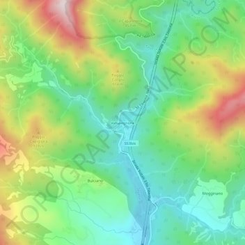
Name: Valsavignone topographic map, elevation, terrain.

Location: Valsavignone, Pieve Santo Stefano, Arezzo, Toscana, Italia (43.71586 12.00522 43.75586 12.04522)

Average elevation: 737 m

Minimum elevation: 510 m

Maximum elevation: 1,149 m

Gear up for your next adventure:

🥾Approach Shoes - Shoes designed for climbing approaches and rugged trails
🌬️Windproof Camp Stove - Efficient cooking even on exposed mountain peaks
🧴Outdoor Sunscreen - High SPF protection for high-altitude UV exposure
🍽️Titanium Camping Spork - Ultralight and indestructible eating utensil
🧊Insulated Water Bottle - Keeps drinks cold in summer and prevents freezing in winter

As an Amazon Associate, this site earns from qualifying purchases at no extra cost to you.