
Make a donation
Gear up for your next adventure:
As an Amazon Associate, this site earns from qualifying purchases at no extra cost to you.
Tromsø topographic map
Click on the map to display elevation.
Make a donation
Gear up for your next adventure:
As an Amazon Associate, this site earns from qualifying purchases at no extra cost to you.
Tromsø
Outside the city, large areas in the municipality are at some altitude and above the treeline with an alpine tundra climate (ET or ETh). The islands to the west at the outer seaboard are milder in winter like Måsvik, making this part of the municipality a (if the −3.0 °C (26.6 °F) isotherm is used) subpolar oceanic climate (Cfc) zone.
Make a donation
Gear up for your next adventure:
As an Amazon Associate, this site earns from qualifying purchases at no extra cost to you.
About this map
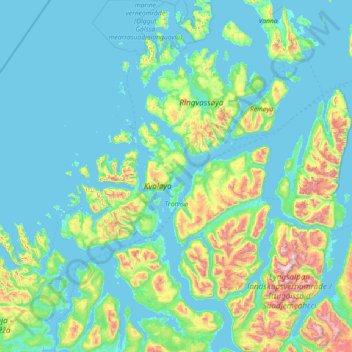
Name: Tromsø topographic map, elevation, terrain.
Location: Tromsø, Troms og Finnmark, Norway (69.28209 17.16005 70.16842 20.04364)
Average elevation: 193 m
Minimum elevation: -3 m
Maximum elevation: 1,817 m
Make a donation
Gear up for your next adventure:
As an Amazon Associate, this site earns from qualifying purchases at no extra cost to you.