
El Eulma العلمة topographic map
Interactive map
Click on the map to display elevation.
About this map
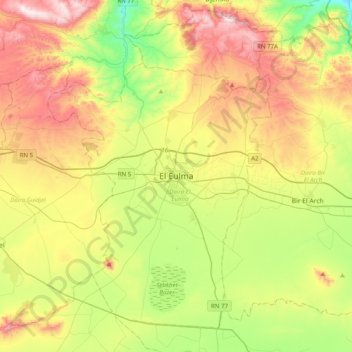
Name: El Eulma العلمة topographic map, elevation, terrain.
Location: El Eulma العلمة, Daïra El Eulma, Sétif, 19605, RADP (35.99291 5.53116 36.31291 5.85116)
Average elevation: 1,003 m
Minimum elevation: 675 m
Maximum elevation: 1,457 m