Geolocate

Carrilancha topographic map

Click on the map to display elevation.

About this map

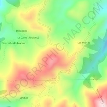
Name: Carrilancha topographic map, elevation, terrain.

Location: Carrilancha, Grado, Asturias, 33826, España (43.29627 -6.10063 43.31627 -6.08063)

Average elevation: 580 m

Minimum elevation: 368 m

Maximum elevation: 834 m

Other topographic maps

Click on a map to view its topography, its elevation and its terrain.

Rio Sama

España > Asturias > Grado

Average elevation: 234 m

Gear up for your next adventure:

🦯Trekking Poles - Reduced impact on joints for steep topographic climbs
🎒Hiking Daypack - Lightweight and durable backpacks for day trips and excursions
🎒Hiking Backpack - Lightweight and ergonomic backpacks for day hikes or multi-day treks
🕶️Polarized Sunglasses - Reduces glare from snow and water at high elevations
🧰Survival Kit - Essential gear for emergencies in the wilderness

As an Amazon Associate, this site earns from qualifying purchases at no extra cost to you.