
Smolyan topographic map
Interactive map
Click on the map to display elevation.
About this map
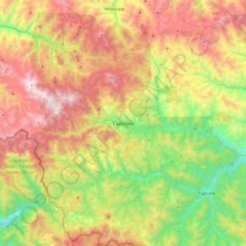
Name: Smolyan topographic map, elevation, terrain.
Average elevation: 1,281 m
Minimum elevation: 579 m
Maximum elevation: 2,179 m
Smolyan (ˈsmɔljɐn, en bulgare. Смолян, translittération internationale Smoljan) est une ville au sud de la Bulgarie, centre administratif de l'oblast de Smoljan et de l'obština de Smoljan. Son nom turc est Paşmaklı ou Ahiçelebi. Avec une altitude située entre 999 et 1 010 m, Smoljan est la ville la plus élevée de Bulgarie.