Geolocate

Binsar topographic map

Click on the map to display elevation.

About this map

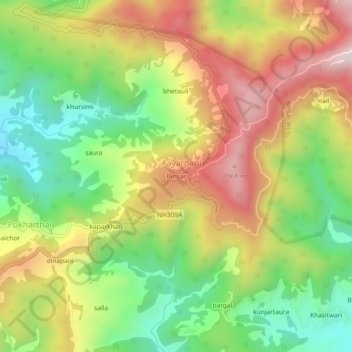
Name: Binsar topographic map, elevation, terrain.

Location: Binsar, Aayarpani, Almora, Uttarakhand, India (29.64995 79.68993 29.68995 79.72993)

Average elevation: 1,629 m

Minimum elevation: 1,313 m

Maximum elevation: 1,999 m

Gear up for your next adventure:

🧰Survival Kit - Essential gear for emergencies in the wilderness
🧥Waterproof Hiking Jacket - Protect yourself from rain and wind while hiking
🧳Compression Sacks - Maximize space in your backpack by shrinking gear
🕶️Polarized Sunglasses - Protect your eyes with durable polarized lenses
🧢Sun Hat - Wide-brim hat for sun protection

As an Amazon Associate, this site earns from qualifying purchases at no extra cost to you.