Geolocate

Sequeiros topographic map

Click on the map to display elevation.

About this map

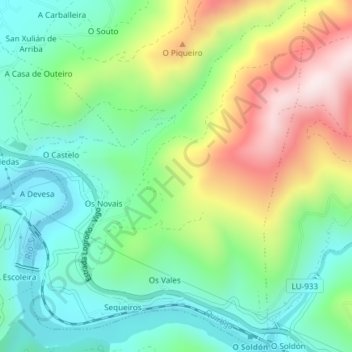
Name: Sequeiros topographic map, elevation, terrain.

Location: Sequeiros, Quiroga, Lugo, Galicia, España (42.44423 -7.25099 42.47181 -7.22163)

Average elevation: 409 m

Minimum elevation: 230 m

Maximum elevation: 741 m

Gear up for your next adventure:

🧥Thermal Layer - Insulating layer for cold outdoor conditions
🦌Outdoor Trail Camera - Monitor wildlife activity near your favorite spots
🧥Ultralight Puffy Jacket - Maximum warmth that packs down to the size of an orange
🚲Bike Repair Kit - Essential tools for on-trail mechanical issues
🔪Outdoor Multitool - Versatile tool for repairs and food prep in the wild

As an Amazon Associate, this site earns from qualifying purchases at no extra cost to you.