
Sardinata topographic map
Click on the map to display elevation.
About this map
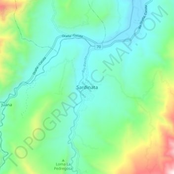
Name: Sardinata topographic map, elevation, terrain.
Location: Sardinata, Norte, Norte de Santander, Colombia (8.04410 -72.84007 8.12410 -72.76007)
Average elevation: 545 m
Minimum elevation: 226 m
Maximum elevation: 1,561 m
Other topographic maps
Click on a map to view its topography, its elevation and its terrain.
Corregimiento El Carmen
Colombia > Norte de Santander > Sardinata > Sardinata
Average elevation: 636 m