

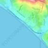
Point Dume topographic map
Click on the map to display elevation.
Point Dume
Offshore, the nutrient-rich and frigid waters of the Pacific enhance the entire marine food web, from primary producers such as algae and zooplankton to apex predators like sand sharks, bottlenose dolphins, and gray whales. Within the Marine Protected Areas (MPAs), the diverse seafloor topography encompasses hills, valleys, grooves, and channels, creating optimal habitats for species such as white seabass, giant sea bass, kelp bass, and lobster. Commonly, harbor seals, sea lions, and dolphins frequent these areas. From February on into the spring, humpback and gray whales, particularly newborn whale calves, are frequently observed as they undertake their coastal migrations.
About this map

Name: Point Dume topographic map, elevation, terrain.
Average elevation: 12 m
Minimum elevation: -3 m
Maximum elevation: 77 m
Other topographic maps
Click on a map to view its topography, its elevation and its terrain.

Legacy Park
United States > California > Los Angeles County > Malibu > Malibu Beach
Average elevation: 44 m