
Make a donation
Gear up for your next adventure:
As an Amazon Associate, this site earns from qualifying purchases at no extra cost to you.
Villa Abecia topographic map
Click on the map to display elevation.
Make a donation
Gear up for your next adventure:
As an Amazon Associate, this site earns from qualifying purchases at no extra cost to you.
Villa Abecia
La localidad se encuentra dentro del valle de Cinti, en el límite con el departamento de Tarija, a una altitud de 2311 m s. n. m. en las estribaciones del norte de la Sierra San Roque en un valle lateral del río Pilaya, un afluente derecho del río Pilcomayo.
Make a donation
Gear up for your next adventure:
As an Amazon Associate, this site earns from qualifying purchases at no extra cost to you.
About this map
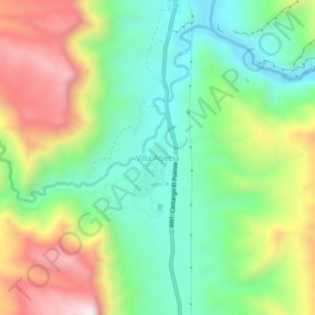
Name: Villa Abecia topographic map, elevation, terrain.
Average elevation: 2,493 m
Minimum elevation: 2,219 m
Maximum elevation: 2,935 m
Make a donation
Gear up for your next adventure:
As an Amazon Associate, this site earns from qualifying purchases at no extra cost to you.