
Thank you for supporting this site ❤️
Make a donation
Make a donation
Gear up for your next adventure:
As an Amazon Associate, this site earns from qualifying purchases at no extra cost to you.
Baraggiola topographic map
Click on the map to display elevation.
Thank you for supporting this site ❤️
Make a donation
Make a donation
Gear up for your next adventure:
As an Amazon Associate, this site earns from qualifying purchases at no extra cost to you.
About this map
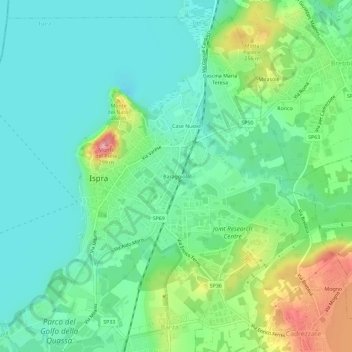
Name: Baraggiola topographic map, elevation, terrain.
Location: Baraggiola, Ispra, Varese, Lombardia, 21027, Italia (45.79565 8.60281 45.83565 8.64281)
Average elevation: 216 m
Minimum elevation: 183 m
Maximum elevation: 295 m
Thank you for supporting this site ❤️
Make a donation
Make a donation
Gear up for your next adventure:
As an Amazon Associate, this site earns from qualifying purchases at no extra cost to you.