Geolocate

Palca topographic map

Click on the map to display elevation.

About this map

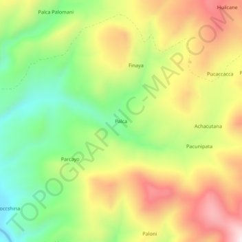
Name: Palca topographic map, elevation, terrain.

Location: Palca, Callalli, Provincia de Caylloma, Arequipa, Perú (-15.52202 -71.18994 -15.48202 -71.14994)

Average elevation: 4,505 m

Minimum elevation: 4,245 m

Maximum elevation: 4,801 m

Gear up for your next adventure:

🧴Waterproofing Spray - Restore the DWR coating on jackets and tents
🧦Crew Hiking Socks - Comfortable socks for long-distance hikes
🧥Waterproof Jacket - Lightweight rain jackets for hiking and outdoor activities
🌬️Windproof Camp Stove - Efficient cooking even on exposed mountain peaks
🥾Waterproof Hiking Shoes - Durable shoes for wet and rugged trails

As an Amazon Associate, this site earns from qualifying purchases at no extra cost to you.