Geolocate

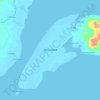
Tigbalabag topographic map

Click on the map to display elevation.

About this map

Name: Tigbalabag topographic map, elevation, terrain.

Location: Tigbalabag, Zamboanga City, Zamboanga Peninsula, 7000, Philippines (7.30237 122.25305 7.34237 122.29305)

Average elevation: 124 m

Minimum elevation: -1 m

Maximum elevation: 475 m

Other topographic maps

Click on a map to view its topography, its elevation and its terrain.

Sacol Island

Philippines > Zamboanga City

Average elevation: 6 m

Vitali River

Philippines > Zamboanga City > Mangusu

Average elevation: 27 m

Sinunug Island

Philippines > Zamboanga City

Average elevation: 0 m

Plaza Pershing

Philippines > Zamboanga City

Average elevation: 4 m

Gear up for your next adventure:

🕯️Camping Lantern - Illuminates your entire campsite with high-efficiency LEDs
⛺Camping Tent - Weather-resistant tents suitable for 2 to 6 people
🗺️Topographic Maps - Detailed maps to explore trails, mountains, and wilderness areas
🩹Moleskin Blister Pads - Direct protection for painful foot pressure points
🧢Sun Protection Cap - Breathable cap to protect from sun exposure

As an Amazon Associate, this site earns from qualifying purchases at no extra cost to you.