Geolocate

Bonilla topographic map

Click on the map to display elevation.

About this map

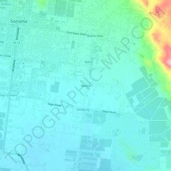
Name: Bonilla topographic map, elevation, terrain.

Location: Bonilla, Sonoma County, California, 95476, United States (38.25797 -122.45776 38.29797 -122.41776)

Average elevation: 30 m

Minimum elevation: 5 m

Maximum elevation: 175 m

Gear up for your next adventure:

🧴Bear Spray Holster - Quick-access carry for essential Canadian wilderness safety
🧣Merino Neck Gaiter - Protects against wind, sun, and cold at high altitudes
🛌Insulated Sleeping Pad - Critical thermal barrier between you and the cold ground
👟Sport Hiking Sandals - Breathable footwear for water crossings and camp rest
🥾Light Trekking Boots - Supportive boots for multi-day treks

As an Amazon Associate, this site earns from qualifying purchases at no extra cost to you.