Geolocate

Castegnate topographic map

Click on the map to display elevation.

About this map

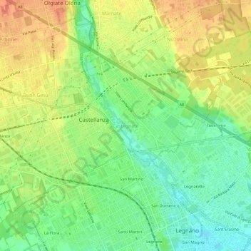
Name: Castegnate topographic map, elevation, terrain.

Location: Castegnate, Castellanza, Varese, Lombardy, 21053, Italy (45.59140 8.88429 45.63140 8.92429)

Average elevation: 221 m

Minimum elevation: 198 m

Maximum elevation: 244 m

Gear up for your next adventure:

🧴Sunscreen SPF - Broad-spectrum sunscreen for outdoor activities
🚲MTB Frame Bag - Carry tools and maps directly on your bicycle frame
🛏️Sleeping Bag - Warm and compact sleeping bags for outdoor camping
🎒Fully Waterproof Backpack - Total protection for photography gear and electronics
🥾Lightweight Hiking Boots - Boots for comfort and mobility on long hikes

As an Amazon Associate, this site earns from qualifying purchases at no extra cost to you.