Geolocate

Sisumut topographic map

Click on the map to display elevation.

About this map

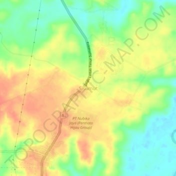
Name: Sisumut topographic map, elevation, terrain.

Location: Sisumut, South Labuhanbatu, North Sumatra, Sumatra, Indonesia (1.93406 100.08374 1.97406 100.12374)

Average elevation: 31 m

Minimum elevation: 6 m

Maximum elevation: 52 m

Other topographic maps

Click on a map to view its topography, its elevation and its terrain.

Cikampak

Indonesia > North Sumatra > South Labuhanbatu

Average elevation: 56 m

Gear up for your next adventure:

🕯️Camping Lantern - Illuminates your entire campsite with high-efficiency LEDs
🚲Handlebar Phone Mount - View topographic-map.com live while cycling
💧Hydration Bladder - Hands-free hydration solution for long treks
Backpacking Tent - Lightweight tent for long-distance hiking trips
🦯Trekking Poles - Reduced impact on joints for steep topographic climbs

As an Amazon Associate, this site earns from qualifying purchases at no extra cost to you.