Geolocate

Mesken topographic map

Click on the map to display elevation.

About this map

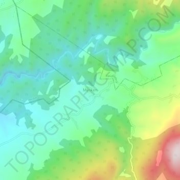
Name: Mesken topographic map, elevation, terrain.

Location: Mesken, Yatağan, Muğla, Aegean Region, Turkey (37.44970 28.23386 37.48970 28.27386)

Average elevation: 587 m

Minimum elevation: 403 m

Maximum elevation: 1,038 m

Gear up for your next adventure:

🧥Softshell Jacket - Windproof and breathable jacket for hiking
🥾All-Terrain Hiking Boots - Versatile boots for varied hiking conditions
🥤Collapsible Travel Cup - Saves space and weight in your mess kit
🔪Outdoor Multitool - Versatile tool for repairs and food prep in the wild
🧴Sunscreen SPF - Broad-spectrum sunscreen for outdoor activities

As an Amazon Associate, this site earns from qualifying purchases at no extra cost to you.