
Thank you for supporting this site ❤️
Make a donation
Make a donation
Gear up for your next adventure:
As an Amazon Associate, this site earns from qualifying purchases at no extra cost to you.
Takhemaret topographic map
Click on the map to display elevation.
Thank you for supporting this site ❤️
Make a donation
Make a donation
Gear up for your next adventure:
As an Amazon Associate, this site earns from qualifying purchases at no extra cost to you.
About this map
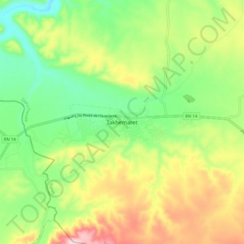
Name: Takhemaret topographic map, elevation, terrain.
Location: Takhemaret, Frenda District, Tiaret, 14015, Algeria (35.06729 0.64336 35.14729 0.72336)
Average elevation: 687 m
Minimum elevation: 567 m
Maximum elevation: 863 m
Thank you for supporting this site ❤️
Make a donation
Make a donation
Gear up for your next adventure:
As an Amazon Associate, this site earns from qualifying purchases at no extra cost to you.