Geolocate

Coates topographic map

Click on the map to display elevation.

About this map

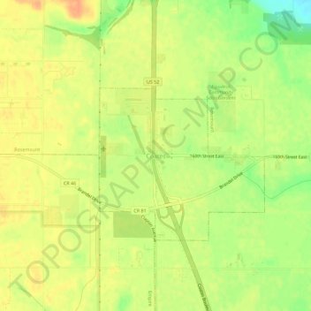
Name: Coates topographic map, elevation, terrain.

Location: Coates, Dakota County, Minnesota, United States (44.69719 -93.05466 44.73719 -93.01466)

Average elevation: 280 m

Minimum elevation: 256 m

Maximum elevation: 293 m

Gear up for your next adventure:

🛏️Camping Sleeping Mat - Comfortable mats for sleeping outdoors
Camping Groundsheet - Protect your tent from moisture and dirt
🥾Light Trekking Boots - Supportive boots for multi-day treks
🔦LED Headtorch - Bright and durable light for night activities
👟Sport Hiking Sandals - Breathable footwear for water crossings and camp rest

As an Amazon Associate, this site earns from qualifying purchases at no extra cost to you.