
Sassenheim topographic map
Click on the map to display elevation.
About this map
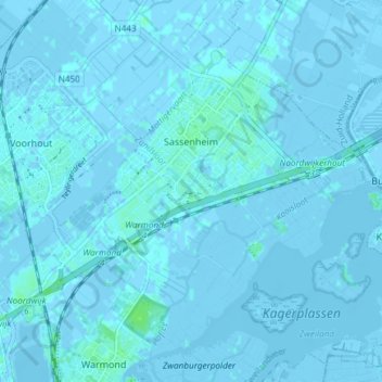
Name: Sassenheim topographic map, elevation, terrain.
Location: Sassenheim, Teylingen, South Holland, Netherlands (52.20130 4.47867 52.23599 4.55323)
Average elevation: 0 m
Minimum elevation: -6 m
Maximum elevation: 6 m
Other topographic maps
Click on a map to view its topography, its elevation and its terrain.
Capelle aan den IJssel
Netherlands > South Holland > Capelle aan den IJssel
Dutch Topographic map of the municipality of Capelle aan den IJssel, June 2015.
Average elevation: -1 m