Geolocate

Col de la Luère topographic map

Click on the map to display elevation.

Col de la Luère

Le col de la Luère se situe à 715 mètres d'altitude dans les monts du Lyonnais et sépare les vallées de la Brévenne et de l'Yzeron aux confins des communes de Pollionnay et Saint-Pierre-la-Palud.

About this map
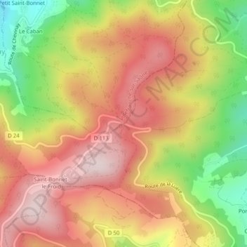
Name: Col de la Luère topographic map, elevation, terrain.

Location: Col de la Luère, Saint-Pierre-la-Palud, Villefranche-sur-Saône, Rhône, Circonscription départementale du Rhône, Auvergne-Rhône-Alpes, France métropolitaine, 69210, France (45.76278 4.62886 45.76288 4.62896)

Average elevation: 620 m

Minimum elevation: 397 m

Maximum elevation: 783 m

Gear up for your next adventure:

🧭Orienteering Kit - Tools for map reading and navigation in the wild
🧴Waterproofing Spray - Restore the DWR coating on jackets and tents
🧊Portable Cooler - Keep food and drinks cold during outdoor adventures
🗺️Topographic Maps - Detailed maps to explore trails, mountains, and wilderness areas
🎒Hiking Daypack - Lightweight and durable backpacks for day trips and excursions

As an Amazon Associate, this site earns from qualifying purchases at no extra cost to you.