Geolocate

Austinburg topographic map

Click on the map to display elevation.

About this map

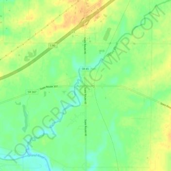
Name: Austinburg topographic map, elevation, terrain.

Location: Austinburg, Ashtabula County, Ohio, 44010, United States (41.75201 -80.87470 41.79201 -80.83470)

Average elevation: 251 m

Minimum elevation: 235 m

Maximum elevation: 264 m

Other topographic maps

Click on a map to view its topography, its elevation and its terrain.

Roaming Shores

United States > Ohio > Ashtabula County

Average elevation: 269 m

Rock Creek

United States > Ohio > Ashtabula County

Average elevation: 248 m

Edgewood

United States > Ohio > Ashtabula County

Average elevation: 214 m

North Kingsville

United States > Ohio > Ashtabula County

Average elevation: 198 m

Ashtabula

United States > Ohio > Ashtabula County

Average elevation: 200 m

Conneaut

United States > Ohio > Ashtabula County

Average elevation: 212 m

Geneva

United States > Ohio > Ashtabula County

Average elevation: 180 m

Jefferson

United States > Ohio > Ashtabula County

Average elevation: 285 m

Gear up for your next adventure:

🧼Biodegradable Camp Soap - Environmentally friendly cleaning for gear and body
🛌Down Sleeping Bag - Superior warmth-to-weight ratio for cold nights
🧭GPS Outdoor Watch - Smart watch for navigation and fitness tracking in nature
🔋Solar Power Bank - Keep your GPS and devices charged during long outdoor trips
🔭Compact Monocular - One-handed bird watching and trail spotting

As an Amazon Associate, this site earns from qualifying purchases at no extra cost to you.