
Thank you for supporting this site ❤️
Make a donation
Make a donation
Gear up for your next adventure:
As an Amazon Associate, this site earns from qualifying purchases at no extra cost to you.
Tauru topographic map
Click on the map to display elevation.
Thank you for supporting this site ❤️
Make a donation
Make a donation
Gear up for your next adventure:
As an Amazon Associate, this site earns from qualifying purchases at no extra cost to you.
About this map
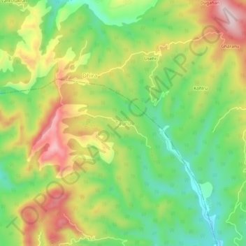
Name: Tauru topographic map, elevation, terrain.
Location: Tauru, Baroh, Kangra District, Himachal Pradesh, India (31.98355 76.37953 32.02355 76.41953)
Average elevation: 862 m
Minimum elevation: 719 m
Maximum elevation: 1,040 m
Thank you for supporting this site ❤️
Make a donation
Make a donation
Gear up for your next adventure:
As an Amazon Associate, this site earns from qualifying purchases at no extra cost to you.