
Thank you for supporting this site ❤️
Make a donation
Make a donation
Gear up for your next adventure:
As an Amazon Associate, this site earns from qualifying purchases at no extra cost to you.
土坪村 topographic map
Click on the map to display elevation.
Thank you for supporting this site ❤️
Make a donation
Make a donation
Gear up for your next adventure:
As an Amazon Associate, this site earns from qualifying purchases at no extra cost to you.
About this map
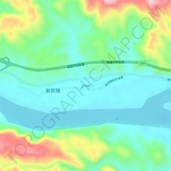
Name: 土坪村 topographic map, elevation, terrain.
Location: 土坪村, Xinmin, Qianwei County, Leshan, Sichuan, China (29.05811 104.08944 29.09811 104.12944)
Average elevation: 370 m
Minimum elevation: 295 m
Maximum elevation: 558 m
Thank you for supporting this site ❤️
Make a donation
Make a donation
Gear up for your next adventure:
As an Amazon Associate, this site earns from qualifying purchases at no extra cost to you.