Geolocate

Scipio topographic map

Click on the map to display elevation.

About this map

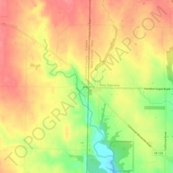
Name: Scipio topographic map, elevation, terrain.

Location: Scipio, Franklin County, Indiana, United States (39.37200 -84.83829 39.41200 -84.79829)

Average elevation: 273 m

Minimum elevation: 224 m

Maximum elevation: 302 m

Other topographic maps

Click on a map to view its topography, its elevation and its terrain.

Oldenburg

United States > Indiana > Franklin County

Average elevation: 288 m

Mount Carmel

United States > Indiana > Franklin County

Average elevation: 307 m

Gear up for your next adventure:

🧳Compression Sacks - Maximize space in your backpack by shrinking gear
🛌Insulated Sleeping Pad - Critical thermal barrier between you and the cold ground
🥾Mountain Trail Shoes - High-traction shoes for mountain trails
🔋Emergency Crank Radio - Weather alerts and power without needing batteries
🚲Heavy Duty Bike Lock - Secure your bike at the trailhead or during stops

As an Amazon Associate, this site earns from qualifying purchases at no extra cost to you.