
Thank you for supporting this site ❤️
Make a donation
Make a donation
Gear up for your next adventure:
As an Amazon Associate, this site earns from qualifying purchases at no extra cost to you.
Jinotega topographic map
Click on the map to display elevation.
Thank you for supporting this site ❤️
Make a donation
Make a donation
Gear up for your next adventure:
As an Amazon Associate, this site earns from qualifying purchases at no extra cost to you.
About this map
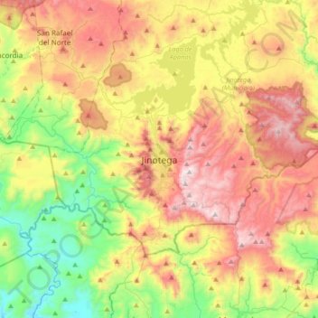
Name: Jinotega topographic map, elevation, terrain.
Location: Jinotega, Jinotega (Municipio), Jinotega, 65000, Nicaragua (12.93104 -86.16236 13.25104 -85.84236)
Average elevation: 992 m
Minimum elevation: 464 m
Maximum elevation: 1,653 m
Thank you for supporting this site ❤️
Make a donation
Make a donation
Gear up for your next adventure:
As an Amazon Associate, this site earns from qualifying purchases at no extra cost to you.