
Thank you for supporting this site ❤️
Make a donation
Make a donation
Gear up for your next adventure:
As an Amazon Associate, this site earns from qualifying purchases at no extra cost to you.
Westland topographic map
Click on the map to display elevation.
Thank you for supporting this site ❤️
Make a donation
Make a donation
Gear up for your next adventure:
As an Amazon Associate, this site earns from qualifying purchases at no extra cost to you.
About this map
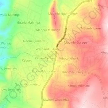
Name: Westland topographic map, elevation, terrain.
Location: Westland, Kabazi ward, Subukia, Nakuru, Rift Valley, Kenya (-0.09596 36.15098 -0.05596 36.19098)
Average elevation: 2,243 m
Minimum elevation: 1,988 m
Maximum elevation: 2,431 m
Thank you for supporting this site ❤️
Make a donation
Make a donation
Gear up for your next adventure:
As an Amazon Associate, this site earns from qualifying purchases at no extra cost to you.